Note: This is one of several blog posts on the history of Alum Hollow and the construction of trails in the Green Mountain Nature Preserve for the Land Trust of North Alabama.
Back up on the plateau, we had one more trail that the Land Trust wanted to create in the northwest corner of the property.
We began flagging for the new trail near where West Plateau Trail starts to bear southward and skirts a small creek that is headed for the Alum Falls area. I knew this creek and had been to this small creek many times as a teenager. Before all the houses were built on the mountain, this was a very remote spot. I knew the small creek as Stonefly Creek.
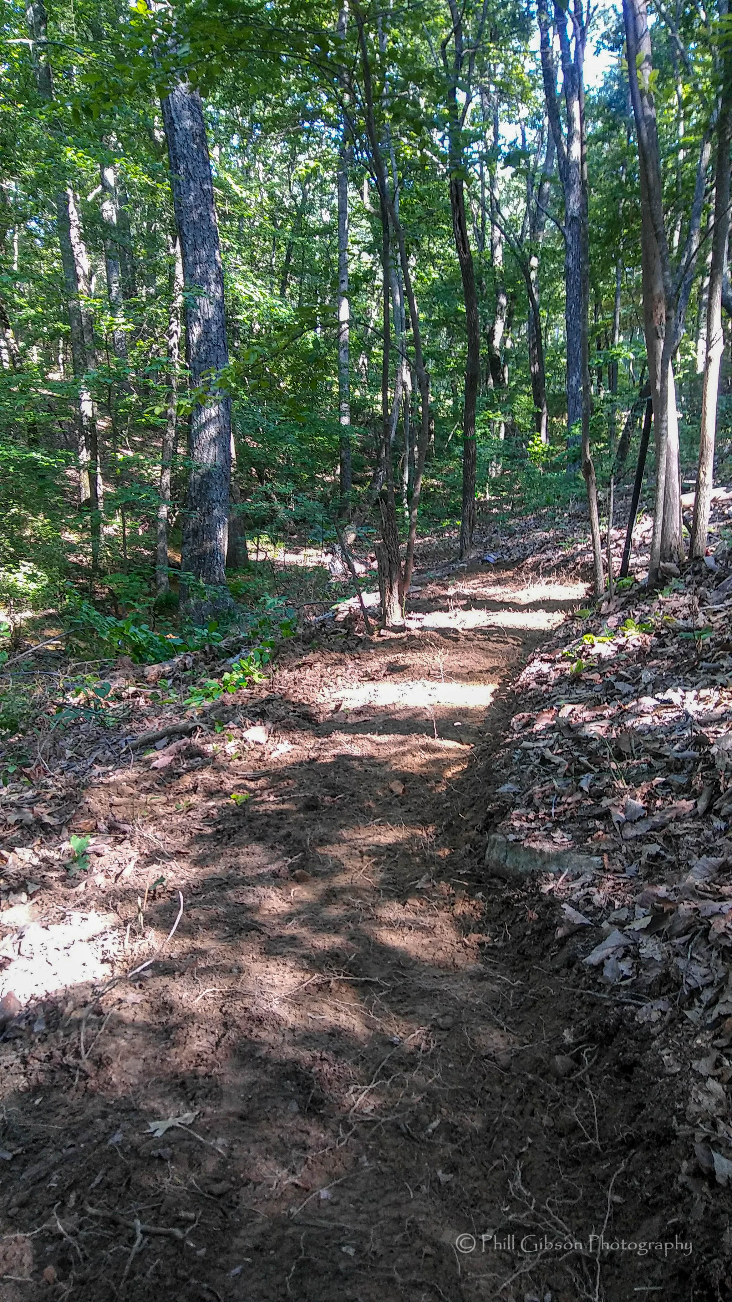
Stonefly Trail as it was being constructed
Back when I was a biology student at UAH, I was very interested in entomological taxonomy – the identification of insects, basically. My studies had taken me to many areas, but this one in particular was the only place on Green Mountain where I had found Stonefly larvae (order Plecoptera) living in the creek. Perhaps it was because the micro-habitat was so distinct; the creek was fed by not just the typical watershed of an Appalachian plateau, but by a small (approximately one acre) marsh just to the north of the powerline. Also, the actual powerline construction, several decades before, had caused a small dam to produce this marsh and had also opened a fair-sized sunny spot upon the creek, allowing several distinct species of marsh plants to flourish here.
But that’s ancient history now. Houses dot the landscape nearby and I’m pretty sure there are no more stoneflies there. At any rate, that is the origin of the name of this area. As we flagged this area, we crossed Stonefly creek, plus two other small creeks on their way to the Alum Falls area. Each of these crossing was fairly small and you could simply jump over the creeks. It is planned to put three small bridges here someday soon.
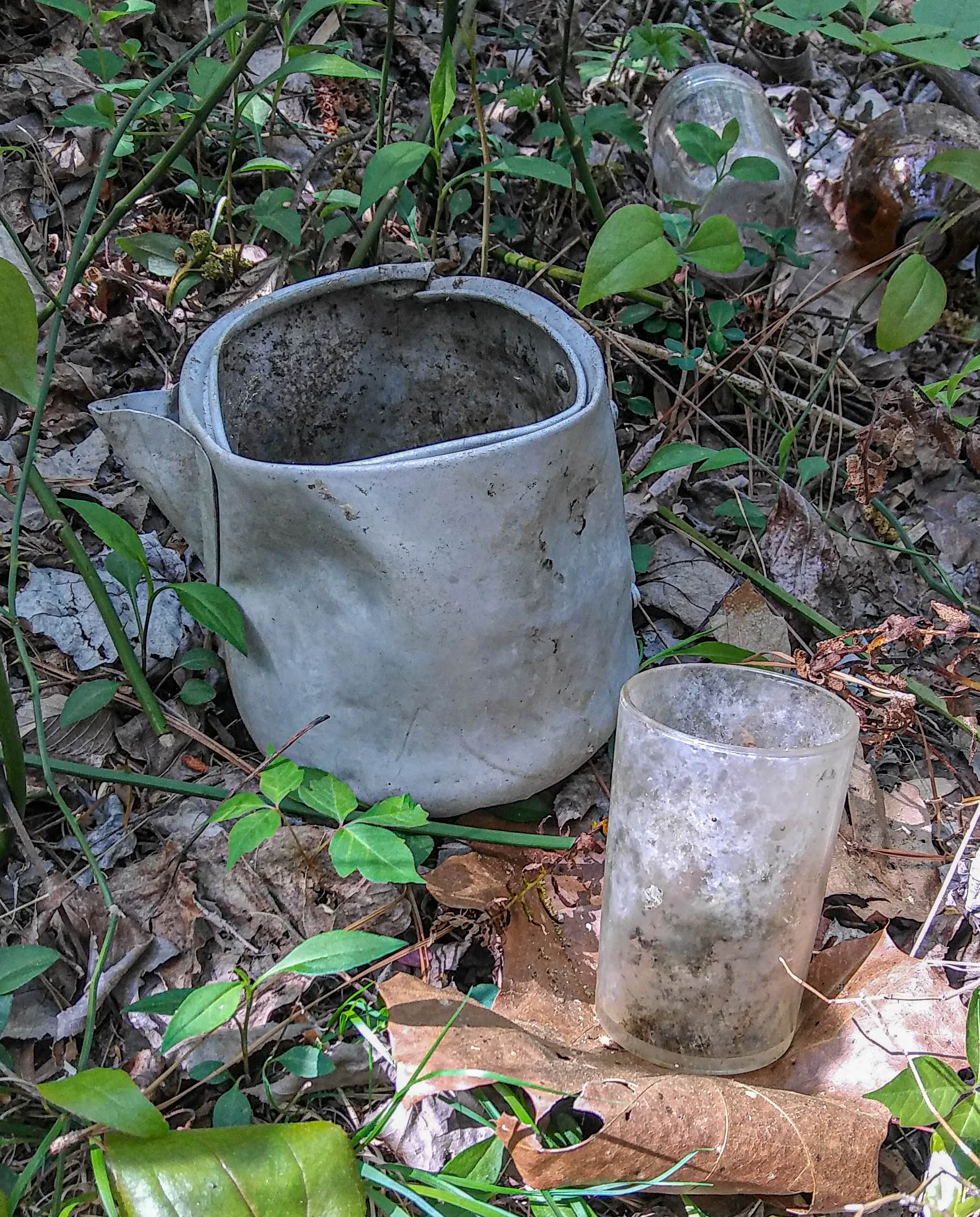
A bit more history. As I mentioned, this was a very remote area. Back in the early twentieth century, this remoteness was put to use by moonshiners. Remnants of moonshine stills and accompanying jars, pots and other items have long been visible around here. Unfortunately, to reveal a still’s location is to seal its doom. We saw this happen over at the Madison County Nature Trail, which originally went by an original moonshine still remnant, it being labeled as such. A decade or two later, there is no visible trace of anything ever having been there.
So in this same area, there is evidence of much human activity. Metal detector scans have revealed items maybe 8 to 12 inches down in certain locations, but we’ll probably never know exactly what they are. Just as well that way, I believe.
A sample of moonshine crockery in the woods
So we began flagging what would be known as Stonefly Trail. This time, Brandon let me do some of the flagging myself, as he had been teaching me the proper way to flag a trail – watching the contours and always keeping water flow across a trail in mind in order to produce a really sustainable trail.
Stonefly Trail provided an extension of Oak Bluff Trail northward past the Alum Falls area, and was designed to be a more convenient route that stayed on the western side of Stonefly creek.
Back in 1950, Huntsville, Alabama was a sleepy little hamlet of maybe 15,000 citizens. Its courthouse square would have fit in quite well as the backdrop for Forrest Gump’s park bench scene in a small Alabama town. You remember: “Life is like a box of chocolates…”. Huntsville’s civic boast back then was that of Watercress Capital of the World. Even today if you visit some of the upscale restaurants downtown, you’ll find a culinary nod here and there to the green that was produced in Big Spring. Like most small southern towns, the area around the courthouse square served as the social gathering spot and the economic hub for buying and selling of goods.
Then, the big announcement came – the old Huntsville Arsenal, used to make ammunition during World War II, would become the focal point of the new space race that America found itself in as the new Redstone Arsenal. Bringing the German rocket scientists from Peenemunde Germany after a brief stay in El Paso, Huntsville soon found itself growing rapidly.
But this growth didn’t fit the usual paradigm for urban expansion seen in most cities. Due to the nature of the work involved in engineering the hardware (not much software back then) that would put men on the moon, the downtown area of Huntsville was really on the sidelines. All this work was on the Arsenal, a few miles southwest of the small but expanding city.
But downtown Huntsville did see some growth. It was a bit sporadic, yet even that was influenced by national trends perhaps more than any local supply-and-demand factors. Downtown Huntsville wasn’t in the space race.
Regardless of the reasons for economic growth, we can identify several periods in history when Downtown Huntsville was obviously expanding.
The first period we’ll look at here was during the 1930s. Although there was one identifiable period of growth earlier around the turn of the 19th century, we’ll start with the 1930s as that period gave us what are still some of Huntsville’s most recognizable downtown landmarks. These include the Russell Erskine Hotel, the Times Building, and the Terry-Hutchens Buildings.
The next notable period of growth came in the 1960s into the early 1970s. This period gave us a totally different architectural style that reflected to some extent the entire nations preoccupation with the space race. The new City Hall and the ever-controversial Madison County Courthouse are good examples of this space-age style. The Central Bank Building (now Renasant Bank) was also constructed during this period, but kept to a more straight-laced style. During this period, we also started to see the effects of the flight to the suburbs, with the associated effect it had on downtown business. Slowly, the vitality and community that was downtown was starting to dwindle.
The next few decades saw a rather subdued growth pattern in downtown Huntsville. Notable buildings would occasionally be built, such as the Regions Building, the Von Braun Civic Center, and the Clinton Avenue and City Hall Parking Decks, the first parking decks in downtown Huntsville.
Population growth from the 1950s onward was somewhat steady, with more growth in the 50s and actually a slight decline in the 80s. But since 1990, population growth has been very steady. And with it, there has been a more steady demand on downtown real estate which has resulted in a sort of filling-in effect, whereby vacant spaces all around the downtown area, and especially on the outskirts of it, have been bought and built upon. In recent years, there has also been a return of retail businesses to downtown.
Because of this more intense demand on downtown space, this more recent growth boom is somewhat different from earlier booms in that the growth has had to be more vertical. Whereas earlier buildings could typically be one or two stories, since the 1990s, most buildings have been at least 4 stories. And more recent buildings are more like 5 or 6 stories.
Unlike the growth patterns in downtown Huntsville from earlier decades, I think this pattern of vertical building due to real estate pressure is probably typical of most cities as they grow. This is seen in the extreme in New York City. If you understand the concept of air rights, you’ll understand why several of the more recent really tall skyscrapers there are literally almost as thin as a pencil! Also, check out this link on air rights in development.
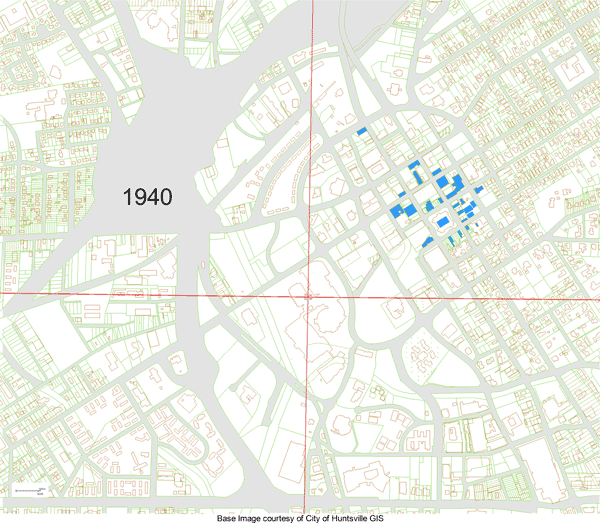
So how does the recent development downtown compare to other decades since World War II? One way to answer that would be to gather all the data on building permits over the years, maybe adjusting for inflation, and set them in a bar chart. That would give you a nice qualitative answer.
But I did it a bit differently for this blog. At the top of this blog is an animated gif I put together in a couple of weekends based on data from the Huntsville GIS Department. If you are interested in such information, then you definitely must check them out!
Here, for instance, I was able to find tax records for all buildings downtown (or anywhere else in the city for that matter), which shows when the building was built, among other details. Then using the same tax map as a base map, I was able to quickly create a background with streets and fill in the buildings as they were built for each decade since 1940. I put these in 10 separate jpg images, one per decade, and then created an animated gif in Photoshop.
Here at the top of the page is the result, showing how buildings have been popping up downtown since 1940. A few notes would be in order as well.
The animated gif above shows all buildings three stories or taller appearing in the map in the decade, with the cutoff being January 1, of the decade year (January 1, 1960, for instance).
All the gray areas are roadways or road right-of-ways.
The red lines are base map quadrant lines. I just kept them in.
Admittedly, three stories is somewhat arbitrary, but I think it fits better and is easier to work with and show meaningful results for, than say, two stories, or even four stories. It is also much easier to find how many stories a building is rather than how tall it is.
It may not be historically perfect, but I have endeavored to be as accurate as I could, keeping with the intent that this should be a quick project. If you see any discrepancies, do let me know. (especially for the Huntsville Hospital block!)
The image for 2030 obviously is based on what has been announced as of just recently. I can see that one changing over the next few years.
I think the main take-away from this little exercise is to notice how downtown density is spreading south and west of the traditional downtown area. And that downtown density is indeed increasing.
And lastly, thanks to The Huntsville GIS Department for their assistance in directing me to the needed data. They have been working hard to put a LOT of data online!