Note: This is one of several blog posts on the history of Alum Hollow and the construction of trails in the Green Mountain Nature Preserve.
All of our trail building at the Green Mountain Nature Preserve up to this point had been on the plateau. So far, we had completed these trails and put up trail marker diamonds:
-
- Alum Hollow Trail
- East Plateau Trail
- West Plateau Trail
The plateau that we are talking about here is the southern-most reach of the Cumberland Plateau. The Cumberland Plateau is, in turn, the southern-most portion of the Appalachian Mountains that extend down into North Alabama. They are easily seen as the ‘tops’ of Green Mountain, Huntsville Mountain, Monte Sano, and Chapman Mountain, plus all the mountains to the east in Jackson County.
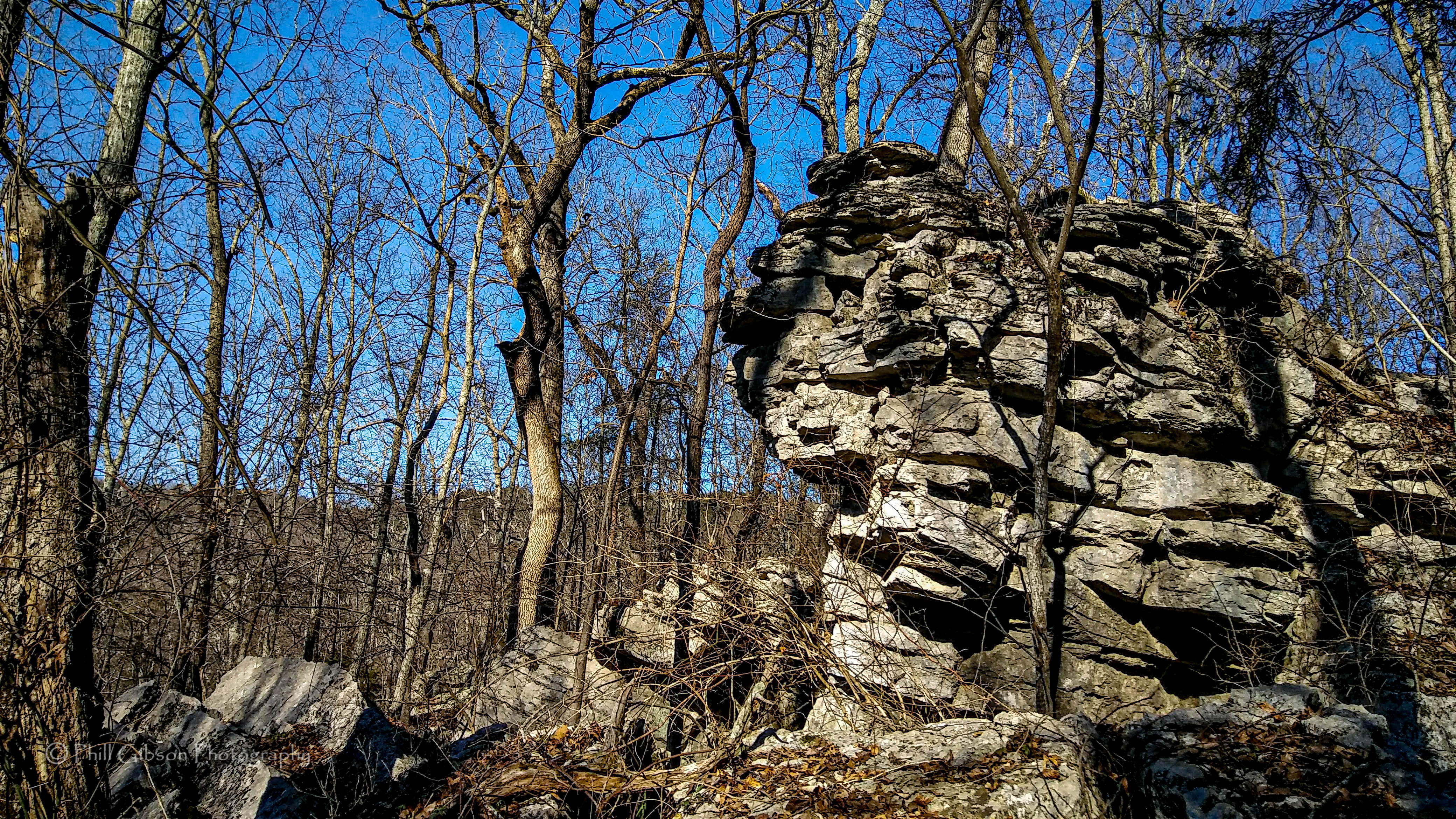
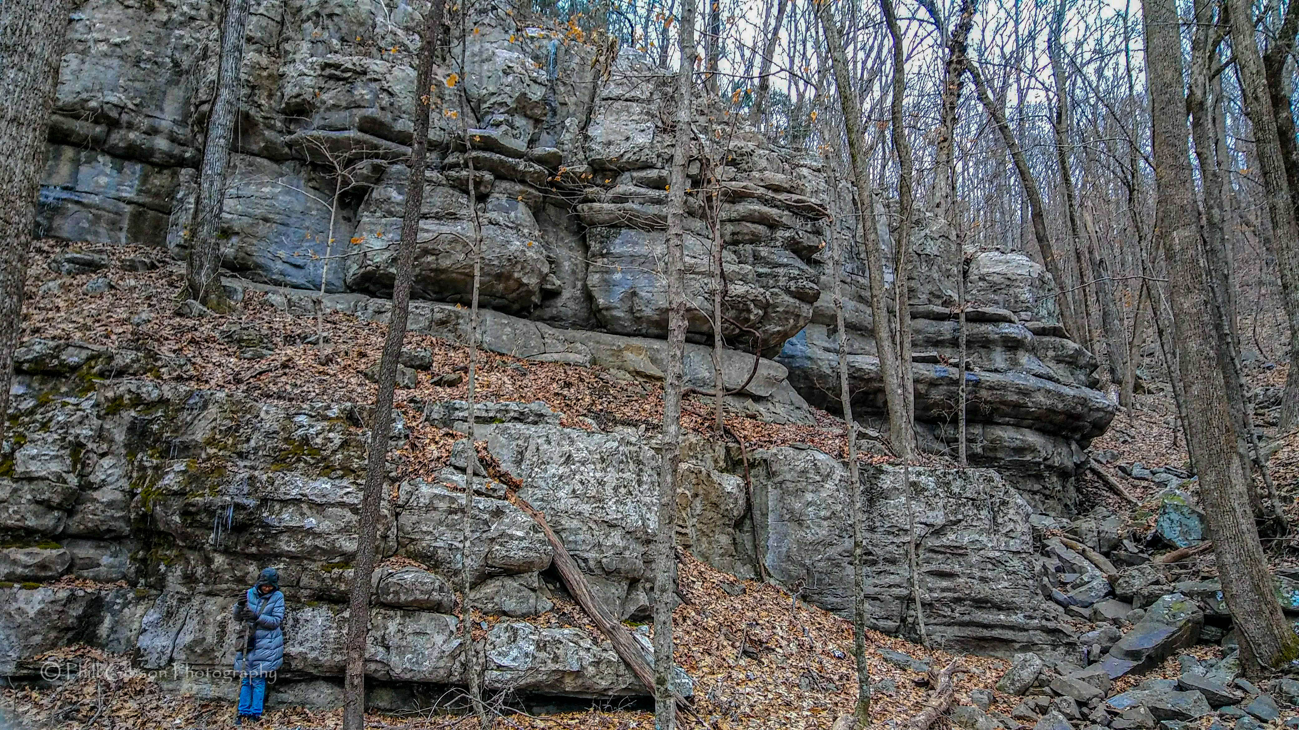
The mountains and their plateaus have several characteristics about them that we can recognize. For instance, most mountains here have a series of shelves ; small plateau-like areas on the slopes before you reach the top plateau. The slopes themselves vary from steep to impassable due to being bluffs of roughly 20 to 50 feet tall. I’ve also been wondering lately if slopes on the eastern-face of a mountain tend to have more caves in them. That is certainly the case on Green Mountain, but I’m not sure if that holds for elsewhere. If indeed that is the case, it would be fascinating!
But we wanted to be able to access the hollow; Alum Cave Hollow as it was known years ago. Now days, it’s simply Alum Hollow. And finding trail routes down into it would prove very challenging.
Brandon, the Land Stewart, and I had talked about finding a way down from the plateau to the hollow on several occasions, but that route was proving to be difficult to find. Most of the western slope there has bluffs just below the plateau, making it impossible to build anything but the most challenging trail. Eventually, he did flag a route down and we started clearing the route. This is the beginning of Ranger Trail, one of the two most difficult trails built there to date (the other candidate for ‘most-difficult-to-build-trail’ is Talus Trail). It was only after several visits that I finally made it to the bottom, coming out on a shelf in what is now known as the Three Sisters area. The Three Sisters are three huge boulders fairly close together. Slow progress was mainly due to the extensive bench-cuts that had to be made for the trail to be walkable.
Eventually, we completed Ranger Trail on the eastern side. It had several challenges, some of which are still with us today, notably the need to construct 2 or 3 well-done switchbacks along very steep slopes. Some of the bench-cuts could also use widening. Then there is the descent into the Three Sisters area. I’ll probably do a separate post on just that part one day.
But even after completing Ranger Trail on the eastern side, it was just getting started! We had a considerable way to blaze on the shelf, crossing two very rocky outcrops before Turtle Creek, then two more outcrops after the creek. About half way between Turtle Creek and Alum Cave Ledge, the trail leads to a most interesting promontory. If you look at the whole preserve on a map, this promontory sits right in the middle. Due to the slopes surrounding it, it is very secluded; higher slopes to the north, and lower slopes in all other directions. There is an old campsite here. I’m not surprised at that, as it is a great place to stop. Eventually, I hope we can put at least a couple of benches if not a table there.
From the Promontory, the trail continued west, gradually rising until it arrived at Alum Cave Ledge. But to get there, the last 200 or so yards were extremely rocky, with large boulders that mostly couldn’t be moved. Even if you moved some of them, what lie beneath the boulders were even more jagged rocks, so you would wind up just replacing the first boulder! Currently, we are thinking of just rerouting this rocky portion.
Speaking of extremely rocky outcrops, another option for dealing with sections that are too rocky to make a good trail, besides just rerouting the trail, is to locate a nearby source of topsoil. Dig out this ‘borrow pit’ to place among the rocks. This works very well, but is very labor-intensive. The topsoil packed in among the rocks has the added advantage of making a well-recognized trail among the rocks, which can be a problem if there are many rocks all around – that means there is no opportunity to beat a path in the rocks, so the trail remains unrecognizable. Once, I did a section of about 15 feet in one of the outcrops along Ranger Trail by myself, and it took about an hour of hard work. Next time, I’ll save this for a work day!
In the meantime, while we were working on Ranger Trail we did find another route down to the bottom of the hollow; this one became Talus Trail. It follows a slightly more natural path between the ledges to the first shelf, then does a series of switchbacks before the descent down to the Underground Creek area. Although it goes much further down than Ranger Trail, the portion that descends to the bottom level of Ranger Trail is indeed more gradual. As with Ranger Trail, Talus also needed a lot of bench-cuts. With both trails, we held a number of work days to mainly do bench-cutting, which were well-attended, sometimes by as many as 20 or 25 people.
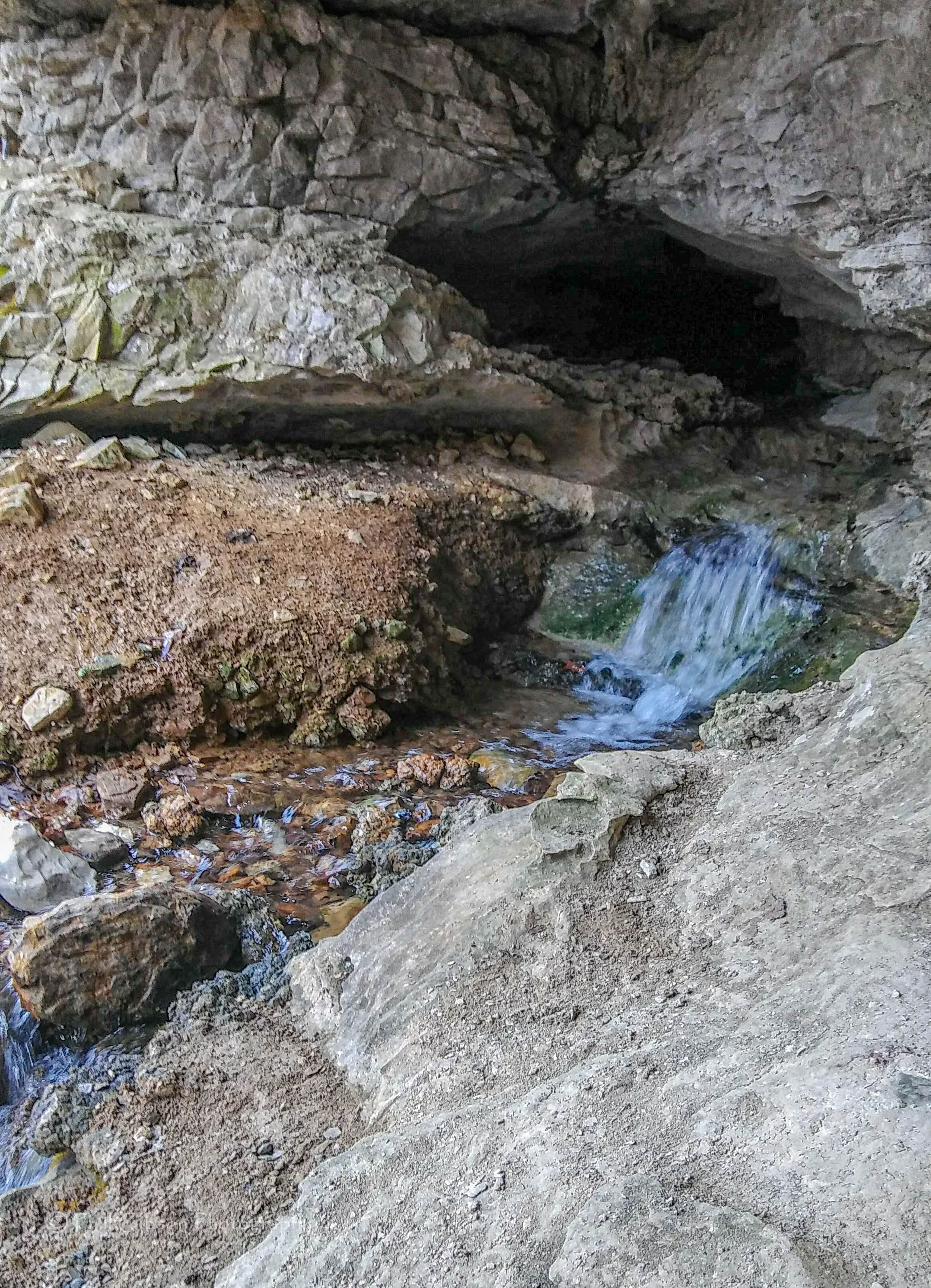
The Underground Creek was new to me. I had never visited it growing up, I wonder what else may be awaiting us as we explore further down and further south in the hollow.